West Herzegovina Canton (Zapadnohercegovački Kanton)
The West Herzegovina Canton (Županija Zapadnohercegovačka, Zapadnohercegovački kanton) is one of the cantons of the Federation of Bosnia and Herzegovina. The West Herzegovina Canton is in the Herzegovina region in the southwest of Bosnia and Herzegovina. Its seat of government is in Široki Brijeg, while other municipalities within the Canton are Grude, Ljubuški and Posušje. It has 94,898 inhabitants, of whom more than 98% are ethnic Croats.
The majority of the present-day West Herzegovina Canton was part of Zachlumia, the medieval South Slavic principality. In the 15th century it became part of the Duchy of Saint Sava under Stjepan Vukčić Kosača, who proclaimed himself the herzog (duke), thus giving the name for the whole region - Herzegovina. The Ottomans conquered Herzegovina in 1483, when the territory of the West Herzegovina Canton became part of the Sanjak of Herzegovina. In 1833 the Sanjak of Herzegovina became more autonomous under Ali-paša Rizvanbegović, who became pasha of the Herzegovina Eyalet, however, after his death, Herzegovina once again became a sanjak. In 1878 the whole territory was occupied and later in 1908 annexed by the Austria-Hungary, who held it until 1918. During that time, the territory of the West Herzegovina Canton was part of the District of Mostar in the Condominium of Bosnia and Herzegovina. After the collapse of the Austria-Hungary and after the creation of the Kingdom of Serbs, Croats and Slovenes, the territory of the West Herzegovina Canton remained part of the District of Mostar. However, with creation of banovinas in 1929, the territory became part of the Littoral Banovina, and in 1939 it was incorporated in the Banovina of Croatia, where it de iure remained until 1943.
During the World War II, the territory of the West Herzegovina Canton became part of the Independent State of Croatia, a Nazi-affiliated puppet state created in April 1941. Administratively, it was part of the County of Hum, having Mostar as its capital. The puppet state collapsed in May 1945.
The Yugoslav Partisans formed the People's Republic of Bosnia and Herzegovina (later renamed to Socialist Republic), as a federal unit of Yugoslavia, of which the territory of the West Herzegovina Canton became part as well. However, in the process of the collapse of the communist regime, ethnic Croats formed the Croatian Community of Herzeg-Bosnia, which encompassed all Croat-majority municipalities in Bosnia and Herzegovina, including those of the West Herzegovina Canton.
During the course of the Bosnian War, the Croatian Community of Herzeg-Bosnia was later proclaimed a republic in 1993. The following year, in 1994, it became part of the Croat-Bosniak Federation of Bosnia and Herzegovina, which led to the formation of ten cantons in June 1996, including the West Herzegovina Canton.
Map - West Herzegovina Canton (Zapadnohercegovački Kanton)
Map


Country - Bosnia_and_Herzegovina
 |
 |
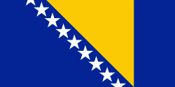
| Flag of Bosnia and Herzegovina | |
The area that is now Bosnia and Herzegovina has been inhabited by humans since at least the Upper Paleolithic, but evidence suggests that during the Neolithic age, permanent human settlements were established, including those that belonged to the Butmir, Kakanj, and Vučedol cultures. After the arrival of the first Indo-Europeans, the area was populated by several Illyrian and Celtic civilizations. Culturally, politically, and socially, the country has a rich and complex history. The ancestors of the South Slavic peoples that populate the area today arrived during the 6th through the 9th century. In the 12th century, the Banate of Bosnia was established; by the 14th century, this had evolved into the Kingdom of Bosnia. In the mid-15th century, it was annexed into the Ottoman Empire, under whose rule it remained until the late 19th century. The Ottomans brought Islam to the region, and altered much of the country's cultural and social outlook.
Currency / Language
| ISO | Currency | Symbol | Significant figures |
|---|---|---|---|
| BAM | Bosnia and Herzegovina convertible mark | KM or КМ | 2 |
| ISO | Language |
|---|---|
| BS | Bosnian language |
| HR | Croatian language |
| SR | Serbian language |